
Excavator, posi-track and tipper from Murwillumbah
Excavation and earthworks in Murwillumbah and the Tweed Valley
Luke runs his own excavator, posi-track and tipper from Murwillumbah, taking on farm dams, creek crossings, rural driveways, trenching and land clearing across the Tweed Valley.
Or send the job details online
- Google 5.0 out of 5 from 2 reviews
- Liability and equipment insurance held
- ABN 58 346 068 875
- Based in Murwillumbah NSW 2484, in the Tweed Valley
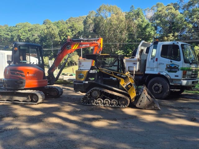
- 5.5 t class Kubota excavator, ASV posi-track, Fuso tipper
- Owner-operator: Luke quotes and runs the machines
- Spoil to lawful tips or approved sites, with dockets
- Owner-operatorLuke, over 10 years operating machinery
- Based in MurwillumbahWorking the Gold Coast to Lennox Head
- Insurance heldLiability and equipment, certificate on request
- Google 5.0 out of 5From 2 reviews, October 2026
- ABN 58 346 068 875Registered business name DIRT WERKS
Based in Murwillumbah, working the Tweed Valley
Dirt Werks is Luke, an owner-operator based in Murwillumbah NSW 2484. He covers the Tweed Valley, including South Murwillumbah and Bray Park, Uki, Tyalgum and Chillingham, and Stokers Siding and Burringbar to the south. Luke quotes each job and runs the machines himself, so the person who prices your job is the person on the controls.
If you need excavator or digger hire in Murwillumbah, Luke works on wet hire: the machine comes with him as the operator. He runs a 5.5 t class Kubota U55-4 excavator, an ASV RT-60 posi-track and a Fuso Fighter tipper that carries about 7.5 t a load, so one booking can cover the digging, levelling and carting. Closer to the coast, see Tweed Heads, Pottsville and Cabarita or every area Luke covers.
Earthworks Luke takes on around the valley
More photos of this kind of work are on the projects page.
Farm dams and creek crossings
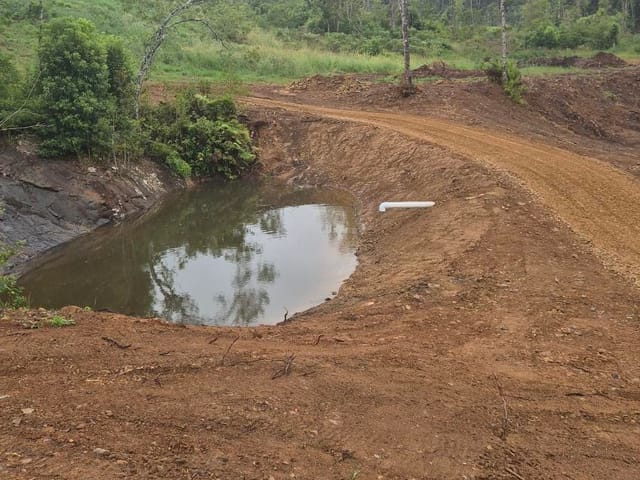
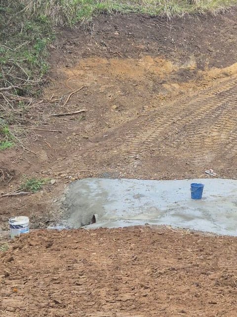
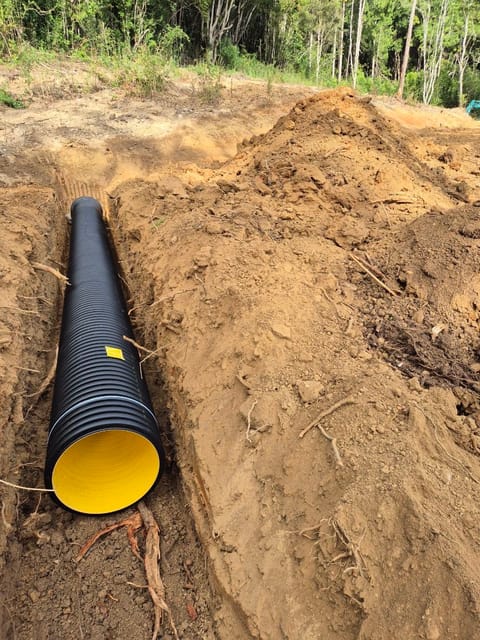
Dams dug with the Kubota, with access tracks formed around them. Crossings get approach ramps cut in, the bed dug out, the culvert pipe laid and gravel spread on the approaches.
See moreRural driveways and access tracks
The base prepared, gravel or road base tipped through the tailgate and levelled with the posi-track, then watered from a hired water truck and rolled. Sealing is done by others.
See moreFence-line and block clearing
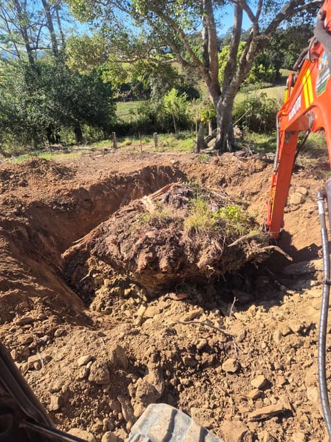
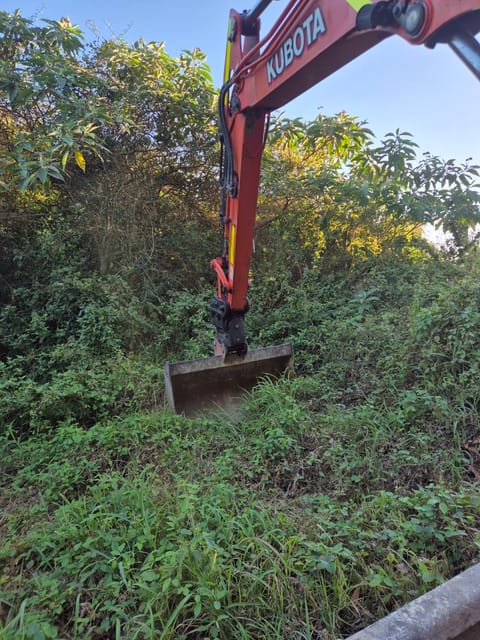
Scrub and regrowth cleared, and trees and stumps taken out at your request, root ball and all, with the grab to handle the logs.
See moreTrenching and drainage
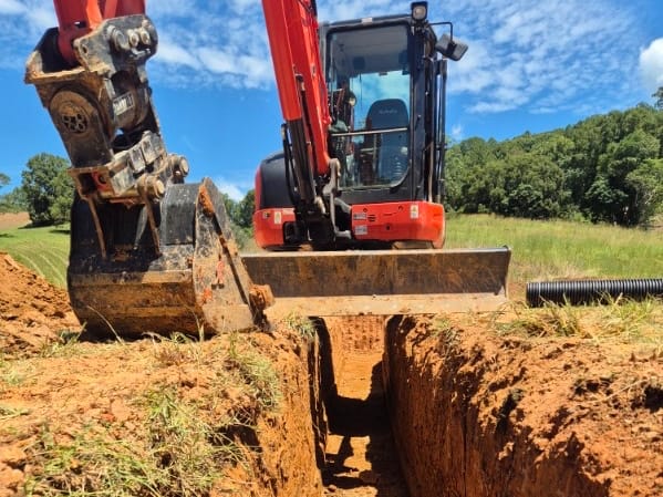
Luke digs and backfills; your licensed plumber or electrician lays and connects. On rural jobs he lays culvert and drainage pipe himself, including farm ag drains, and backfills over it.
See moreSoil out, gravel in
Spoil and rubbish carted out on Luke's tipper, and road base, gravel or soil brought in from quarries.
See moreTanks and auger holes
Tank installs on farms and rural blocks, and auger holes for fence posts, farm sheds and rural structures.
See moreThe ground: volcanic slopes and river flats
The Tweed Valley is the eroded caldera of the Tweed shield volcano, which erupted about 23 million years ago, and Wollumbin (Mount Warning) is its central core. NSW groundwater mapping notes describe basalt-derived 'chocolate' soils (krasnozems) on the plateaus and steeper slopes, usually well drained, and estuarine sediments and alluvium on the floodplain. The basement rock is the Neranleigh-Fernvale Group, metamorphosed greywacke and shale, and the rhyolites of the Chillingham Volcanics outcrop at Chillingham.
Steep hinterland ground can slip when it is saturated. In the 2022 flood, Tweed Shire Council reported major landslips on Tyalgum Road and Reserve Creek Road, and severe damage on Kyogle Road and Mount Warning Road. The Tyalgum Road slip was about 100 m high, 60 m long and up to 10 m deep.
So when you send photos, tell Luke if you've hit rock on the block before, if the ground stays wet, or if the spot is low and close to a creek. Each of those changes the machine time, the drainage and where the spoil can go.
River flats, flood rules and the 2022 flood
Rain on the upper catchment is funnelled by the caldera into the Oxley, Rous and Tweed rivers, and South Murwillumbah floods when the Oxley meets the Tweed at Byangum. The NSW SES lists 2022 as the flood of record, at 6.51 m on the Murwillumbah gauge against 6.12 m in 2017, and the South Murwillumbah levee overtops at 4.80 m. Council reported that Uki, Mooball, Burringbar and Crabbes Creek were hit harder in 2022 than in past floods.
Council's flood chapter, DCP Section A3, had its flood planning levels revised on 4 March 2026. It defines high flood hazard areas in South Murwillumbah, Bray Park, Upper Burringbar, Burringbar and Mooball. On urban-zoned land in Murwillumbah, South Murwillumbah, Bray Park, Condong and Tumbulgum, where fill for drainage is allowed, a site must be filled to at least the centreline level of the road in front and graded to drain to the street or another approved drainage system.
Mapped high flow areas have a tighter rule. There, on rural (RU1, RU2), large-lot residential (R5) and environmental (C1 to C3) land, other development, including structures ancillary to a house, is allowed only if it changes ground levels by no more than 300 mm, for local drainage, and does not obstruct flood flows. The high flow maps are in Appendix D of DCP A3, so check them before planning fill on the flats.
DCP A3 advises buyers and developers to get a Section 10.7 certificate and a Property Flood Report for a block's flood levels, because levels change as flood studies are updated. Both are worth having before planning earthworks on the flats. Low-lying estuarine sediments can also be acid sulfate soils: once drained or dug and exposed to air, the pyrite in them oxidises to sulfuric acid and the soil pH can fall below 4. Council's written approval is needed in most cases before these soils are disturbed, and a site-specific management plan is needed where groundwater is likely to be disturbed or dewatering is likely.
Farm dams: what harvestable rights allow
In NSW coastal-draining catchments like the Tweed, harvestable rights let landholders capture and store up to 10% of the average annual regional rainfall runoff from their land. The limit was returned to 10% from 30% in September 2023, so older advice on dam size may be out of date. Harvestable-rights dams can go on hillsides, gullies and non-permanent first- and second-order streams, but not on a third-order or larger stream, or within 3 km upstream of a Ramsar wetland.
If the dam you want doesn't fit within harvestable rights, check the NSW water rules for the approvals it needs before the machine arrives. Spoil the block can't use goes out on Luke's tipper. For the tracks and clearing that go with a dam, see land clearing and rural earthworks.
Other local rules to check before work starts
Sort these out before the machines arrive. The council approval guide covers the common questions.
- A driveway onto a Council road. Work in the road reserve, including driveways, kerb and gutter changes and footpaths, needs Council consent under section 138 of the Roads Act 1993. The property owner is responsible for providing and maintaining the access, and a driveway built in the road reserve without approval may have to be removed if Council deems it a safety or public liability risk.
- Trees on non-rural land. Clearing declared vegetation needs Council approval, and lodging is free. That includes native plants 4 m or taller or 10 cm or more in diameter, any tree 40 cm or more in diameter, preferred koala food trees and threatened species. Under DCP 2025, vegetation within 5 m of an existing lawful house on the same land can be cleared without a permit, but not large trees, koala food trees, hollow-bearing trees or threatened species. Check with Council before removing any tree.
- Clearing on rural land (RU1, RU2). Clearing native vegetation may need approval under the Local Land Services Act 2013. NSW allowable activities let rural landholders clear the minimum needed for some farm infrastructure, such as fences, tracks and dams, without that approval, within set maximum widths. Council or other approvals may still apply.
Rural jobs from Luke's photo set
Got a job in the Tweed Valley?
Text Luke a wide photo, the gate or track in, and the exact spot. He quotes from photos, or from a site look if the job needs it.
Murwillumbah and Tweed Valley questions
Can you get a machine up a steep or wet farm track?
It depends on the ground on the day. The excavator and posi-track run on tracks, but the Fuso tipper is a truck, and Luke only tips it on level, firm ground. Send photos of the track from the gate, the steepest pinch and the work spot, and say how much rain has fallen. If the track won't carry the machines safely, a drier day is the better call.
I have several small farm jobs. What should I send Luke?
List them in one message, for example a fence line to clear, a washout on the drive and a culvert to replace. Send a photo of each spot and one of the gate, and say where any spoil can go. That tells Luke which of the excavator, posi-track and tipper the list needs, and which machine suits the access.
Do I need approval to fix or build a creek crossing?
Check first. In NSW, waterfront land is the bed of a river, lake or estuary plus the land within 40 m of the bank on each side. Works there, such as building roads or bridges, laying pipes in a watercourse, and removing or depositing rock, gravel or fill, are controlled activities. Not every activity needs approval. Applications go through the NSW Planning Portal, and most also need Council approval. The landowner arranges it, and Luke builds to it.
Does the fire ant zone affect moving soil out of Murwillumbah?
Yes, if the job is inside the movement control area. Fire ant nests were found at South Murwillumbah on 24 November 2023, and a 5 km movement control area was set up around them. NSW DPIRD's guide to Emergency Order (No. 10) 2026, dated 1 September 2026, shows it still in place. Moving soil, mulch, turf, gravel, earth-moving equipment and tipper trucks out of it is controlled. Check the NSW DPIRD zone map first, and report suspected fire ants to the NSW Biosecurity Helpline on 1800 680 244.
Where does the spoil go, and can I keep it on the block?
Spoil leaving the property goes on Luke's tipper to lawful tips or approved sites, with dockets. To keep it on the block, ask Council first: Council says filling land needs development consent in most cases. Where the NSW acid sulfate soil risk maps show any probability of those soils, the spoil can't be classed as virgin excavated natural material unless it is chemically assessed under the NSW guidelines, and reduced inorganic sulfur above the lab's limit of reporting rules it out.
Sources (checked October 2026)
- Tweed Shire Council: Development Control Plan 2025, effective 1 June 2026
- Tweed Development Control Plan 2025 (PDF)
- Tweed DCP Section A3: Development of Flood Liable Land (PDF, version 1.7, 4 March 2026)
- NSW SES: South Murwillumbah flood guide (PDF, October 2025)
- Tweed Shire Council: full impact of Tweed's biggest flood (March 2022)
- Tweed Shire Council: major landslips and road damage (March 2022)
- Tweed Shire Council: Tyalgum Road access restored (October 2023)
- Tweed Regional Museum: geological history
- NSW Department of Land and Water Conservation: Tweed-Brunswick groundwater vulnerability map explanatory notes (PDF, 1997)
- Tweed Shire Council: acid sulfate soils
- Tweed Shire Council: disposal of fill
- NSW EPA: virgin excavated natural material
- NSW Water: harvestable rights in coastal-draining catchments
- NSW Water: controlled activity approvals on waterfront land
- Tweed Shire Council: driveway access to property guide (PDF, October 2021)
- Tweed Shire Council: trees on private land
- NSW Government: allowable activities on rural land
- Tweed Shire Council: fire ants
- Tweed Shire Council: fire ant update (November 2023)
- NSW DPIRD: Plain English Guide to Biosecurity (Fire Ant) Emergency Order (No. 10) 2026 (PDF, 1 September 2026)
- NSW DPIRD: fire ant maps of infestations and zones
Suburbs
Towns and suburbs around Murwillumbah
Each one has its own page with the ground, the access and the local rules to check.
Related
Tweed Heads
Excavator, posi-track and tipper work in Tweed Heads, Banora Point and Terranora: trenching, driveways, soil removal.
See more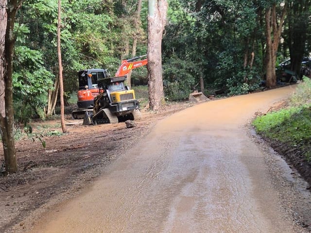
Pottsville & Cabarita
Earthworks in Pottsville, Cabarita Beach, Hastings Point and Mooball: driveways, trenching, clearing, deliveries.
See more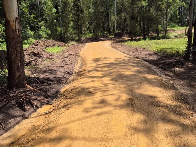
Projects
Photos from Dirt Werks jobs: gravel driveways and tracks, drainage trenches, farm dams, creek crossings, clearing and stumps.
See moreCouncil approval to excavate
When digging, filling or a retaining wall needs council approval in the Tweed, Byron and Ballina shires, with official sources.
See more